Western Wyoming Region

Trip Reports  Video Library  Photo Gallery  GPS Library  Weather  Web Cams  Useful Links

Trip Reports

Maybe it’s where you were born and raised, Maybe it’s what you learned from your parents, Or maybe it is what burns deep inside you. I just know that some dreams grow stronger the longer you live. For me, the only place is the mountains, this is where I belong. This is my dream. - cf - This year I made good on a dream that has been with me my entire life. Sometimes it smoldered, other times it burned bright, but it was always there. My childhood home, (from birth until I was a freshman in high school), was ...
Contributor: Cody Feuz Riders: Cody Feuz, Phil Clemens Activity Type: Mountain Biking     Level of Difficulty: Advanced - Trail is 24+ miles, many stream crossings, and multiple technical rock/tree sections. Mountain Range or Region: Bridger-Teton National Forest     State: WY     Country: USA The Adventure: I’ve wanted to do this ride for several years, but I needed to do some research first.  I wasn’t sure about the upper end of the trail, and where the Gros Ventre Wilderness boundary was.  Earlier this summer we hiked into Shoal Lake from Riling Draw.  I was able to scout out the upper valley and we found ...
OK, I admit it. Occasionally I edit out stuff from my GoPro videos. Here is some recent stuff. The video below cotains the low-lights of the crashes and some cowpie dodging that we encountered on the Wyoming Peak and Shoal Creek trips. The best, (as in most blood drawn and most potential for bodily harm), was not actually caught on camara, but the video does show where it occured. Humorous now, but it was a good thing we had basic first aid along, and it reinforces the risk of some of these rides. Phil's "crash" occured at almost 11,000 feet ...
I have now completed this ride 3 times since 2009. Each time has been dramatically improved in terms of the overall experience. The first year we got lost, trying to find the trailhead. That adventure is documented here, First two Wyoming Peak Rides. Last year was much better, but I had intended to shoot GoPro video of the ride and left my memory card in the Explorer at the trailhead. This year I checked out a different access road further to the south on Greys River Road, and it proved to be a much easier and consistent approach. This cut ...
The Adventure: The trek was inspired by my youngest brother. He and his son are runners and do a lot of hiking and hunting. We had both been into Shoal Lake once on separate occasions with our dad. He had taken us in on horseback, overnight pack trips when we were in the 8th/9th grades. The idea was to see if we could hike in, fish and hike back out in the same day. Ann and I were both up for the trip and so it was game on. We met at 6:30 AM on August 11th at the Elkhorn ...
Activity Type: Mountain Biking Dates of rides: September 10, 2009 and September 21, 2011 Level of Difficulty: Difficult, due to elevation gain and remoteness. Mountain Range or Region: Wyoming Range State: WY Country: USA Riders: (1st ride - Cody Feuz, Phil Clemens, Mike Geslin), (2nd ride – Cody Feuz, Phil Clemens) Total vertical gain: 3,566 ft. Equipment Used: Jamis, Giant, and Specialized full suspension bikes. GPS Data: First trip in 2009, where we were "lost" for quite awhile.  (see the post below). Map data from the 2nd, successful trip in 2011. General Description: Wyoming Peak is the highest peak in ...

Video Library

Photo Galleries

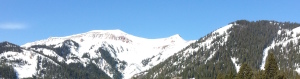
Mountain Biking and Skiing in the Wyoming Range

Monument Ridge-Phil
Monument Ridge - Cody
Wyo Peak heading out
WyoPeak - Cody at Summit
Phil on Wyoming Peak Summit
Mike on the summit
Phil on the Descent
Wyoming Peak
Ramshorn GPS tracks
Ramshorn Peak
Trying to avoid the dirt patches
Snowdrifts
Break time
Cody and Mark Skinning
Mark B on the Ramshorn summit ridge
Ramshorn NE chute Summit
Skiing Ramshorn
Cody Skiing on Ramshorn Peak
Mark at the Kerr Creek Transition
Andrew at the Kerr Creek Transition
Nearing the upper ridge on Ramshorn Peak
Monument Ridge-Phil

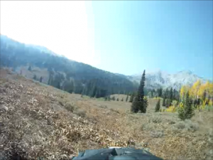
Gros Ventre Range Action – Hiking, Biking, Fishing, and Sledding

Ann and Cody
Wyatt Bridger and Cody
Shoal Creek Upper Gorge
Bridger and Wyatt Fishing
Shoal Lake
Cody Fish On
Disappearing Stream
Bridger and Wyatt Hiking Out
Ann Hiking Out
Shoal Creek
Sledding into Granite Hot Springs
Flying Buttress (north aspect)
Flying Buttress (west aspect)
Shoal Creek Wilderness Border
Phil at the Wilderness Border of Shoal Creek
Shoal Creek Upper Valley
Shoal Creek Lower Valley
Shoal Creek Lower Canyon
Ann and Cody in the upper valley of Shoal Creek.

This set of three galleries chronicles a trip from Greys River thru the Wyoming Range, thru the Hoback valley and finishing in the Upper Gros Ventre area.

All Smiles
Front view
Back view
Greys River view
GR-05
GR-06
GR-07
GR-08
GR-09
GR-10
GR-11
GR-12
GR-13
Ann is enjoying the Greys River!
WYR-19
WYR-18
WYR-17
WYR-16
WYR-13
WYR-14
WYR-15
WYR-12
WYR-09
WYR-10
WYR-11
WYR-06
WYR-07
WYR-08
WYR-05
WYR-04
WYR-03
WYR-02
WYR-01B
WYR-01
This slide occurred just west of the old guest ranch, (v-v).
GV-08
GV-10
GV-11
GV-12
GV-13
GV-14
GV-15
GV-01
GV-02
GV-03
GV-03b
GV-04
GV-05
GV-06
GV-07
The Red Hills overlook Slide Lake.

GPS Library

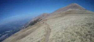
Wyoming Peak Mountain Bike Rides This set of GPS data contains 3 trips to the summit of Wyoming Peak on mountain bikes. All three trips reach the summit, but the first one shows the results of having bad analog map beta and making bad decisions about finding the proper trail head, the second one shows a route with maximum elevation gain, but involves climbing/descending steep grades on F.S roads. The 3rd trip shows the “optimum” route for no bushwhacking and avoidance of steep grades on F.S. roads.

Ramshorn Spring Skiing Tour A successful spring skiing trek that showcases a descent of the NE Bowl. We picked a slightly different approach directly from the highway, and were pleased with the results. We didn’t ski from the summit on this day, due to concerns with cornices and slabs in the steep routes from the top.

Ramshorn Summer Climb Sometimes a nice bushwhack is kinda fun. On the ascent, we missed a key trail marker due to a washout, and so the climb involved more bushwhacking then necessary. On the descent, our group split and some of us descended one of the steep gullies from the summit ridge.

Shoal Creek Mountain Bike Ride This GPS track chronicles a successful mountain bike trip along the length of Shoal Creek, starting at the Hoback River, and reaching a turn-around point where the trail hits the Wilderness boundary. The GPS data includes several useful way points.

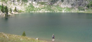
Shoal Lake Trek This GPS track chronicles a day of hiking and fishing that started/finished at the Riley Draw trail head, with Shoal Lake as the destination. 16 miles round trip, with over 3,000 feet of elevation gain.

Weather Report/Forecast

Bondurant, WY
28°
Clear
6:33 am8:08 pm MDT
Feels like: 25°F
Wind: 4mph NW
Humidity: 52%
Pressure: 30.2"Hg
UV index: 0
11 pm12 am1 am2 am3 am
27°F
25°F
21°F
19°F
19°F
FriSatSunMonTue
45°F / 19°F
50°F / 25°F
57°F / 27°F
50°F / 23°F
57°F / 30°F

NOAA Point Forecast for Granite Hot Springs (Elevation 7,027 ft)
NOAA Point Forecast for Cliff Creek Pass (Elevation 9,200 ft)
NOAA Point Forecast for McDougal Gap (Elevation 8,450 ft)
NOAA Point Forecast for Tri-Basin Divide (Elevation 8,650 ft)

Web Cams

Bondurant Web Cam
Webcam provided by WYDOT. Click on image for a full-size view.


Useful Links

Avalanche.org – The “go to” source for avalanche information and education.

EXUM Mountain Guides – Exum Guide Service and School of Mountaineering in Jackson Hole, Wyoming. Exum is the oldest Guide Service in North America.

Mountain Weather – MountainWeather™ is a meteorological consulting company located in Jackson, Wyoming and is owned and operated by meteorologist Jim Woodmencey.

Teton AT – Premier route beta and TR site established by the late Steve Romeo. He provided extensive coverage of the Teton Range, with some other forays into places such as the Wind Rivers in Wyoming.

Teton Gravity Research Forums – TGR’s forums pages are a great source of backcountry beta and TRs. This link should take you directly to the Trip Reports section, but there is a treasure trove of other information in the various forum sections, ranging from technical discussions to adult humor. This is a wide-open forum that allows a liberal amount of first amendment latitude.

Gros Ventre and Wyoming Range SNOTEL Sites

Granite CreekSNOTEL Site: #497 northwest of Bondurant, WY. Latitude: 43 deg; 21 min N, Longitude: 110 deg; 26 min W, Elevation: 6770 feet.

Gros Ventre Summit SNOTEL Site: #506 Gros Ventre Summit on the eastern end of the GV range. Latitude: 43 deg; 23 min N, Longitude: 110 deg; 8 min W, Elevation: 8750 feet.

Blind Bull Summit SNOTEL Site: #353 Blind Bull Summit just south of Deadman Mountain. Latitude: 42.96 Longitude: -110.61 Elevation: 8650 feet.

Triple Peak SNOTEL Site: #831 Triple Peak in the central portion of the Wyo Range. Latitude: 42.76 Longitude: -110.59 Elevation: 8500 feet.

Spring Creek Divide SNOTEL Site: #779 Spring Creek is on the southern end of the Wyo Range. Latitude: 42.53 Longitude: -110.66 Elevation: 9000 feet.


HTML Snippets Powered By : XYZScripts.com

Snow report by Mountain Report & Snow Removal Denver

Visit Us On FacebookVisit Us On TwitterVisit Us On YoutubeVisit Us On Linkedin